Gatsubro is a Master of Architecture-Urban Development Management and a Bachelor of Engineering-Urban and Regional Planning.
I am an experienced analyst. I am quite a strength in analyzing the projections of land use planning, spatial analysis, and land management. I am also good operating other software, such as the ArcGIS program, Global Mapper, SPSS, Adobe Photoshop Graphic Program, Cellular Automata, Ms. Office Word, Ms. PowerPoint, Ms. Excel, Ms. Access, Ms. Visio and others.
GIS Modelling that I can do is Landuse Change Modelling, Transportation Modelling, Spatial Linear Regression, Geographic Weighted Regression, Dynamic System, and Spatial Analysis other.
Remote Sensing and Drones are analytical methods that is using aerial and satellite photos. Some of the work that I can do using Remote Sensing and Drones is Analysis of Patterns of Change in Landuse, Monitoring of Infrastructure Development, Identification of Soil Topography, Electrification, Determination of Potential Fishing Zones and others.
The geographic information system is information of spatial data management in certain institutions/organizations in order to organize services to the community. The development of computer-based information systems in Indonesian began to be initiated in accordance with the understanding of the concept of smart cities and the realization of good governance.
At present Mobile GIS (Mobile Geographic Information System) is a necessity. Mobile GIS is an integration between three technologies, namely GIS software, Global Positioning System (GPS) technology, and handheld communication devices. In general, Mobile GIS is implemented in 2 main application areas, namely: Location Based Services and Field Based GIS.
Following are some of the project results that I have completed based on the four classifications above.
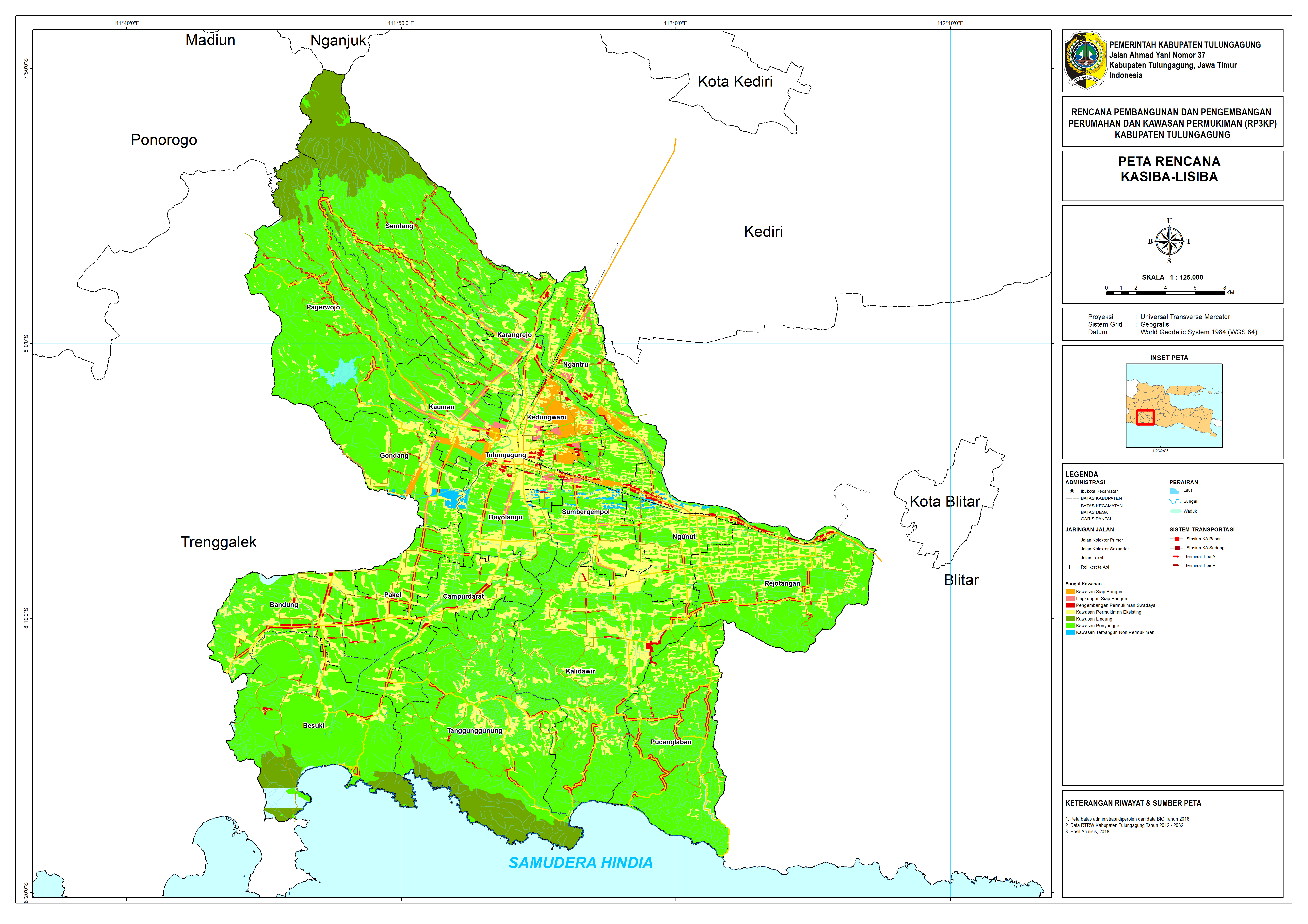
The above modeling uses the cellular automata approach. Details
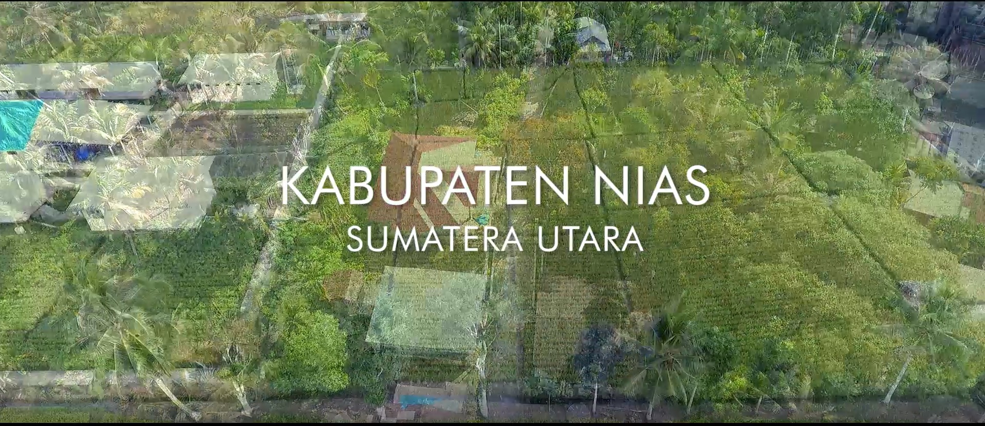
By using drones, we can find out the condition and progress of road development. Details
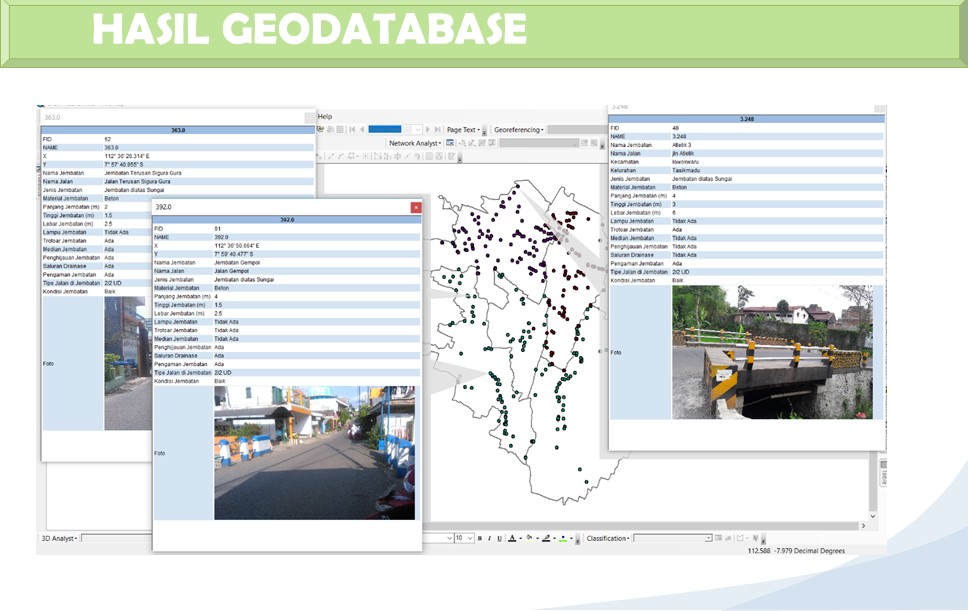
Geodatabase is very helpful in data collection and storage of spatial data. Details
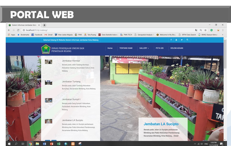
Bridge Information System Website Interface. Details
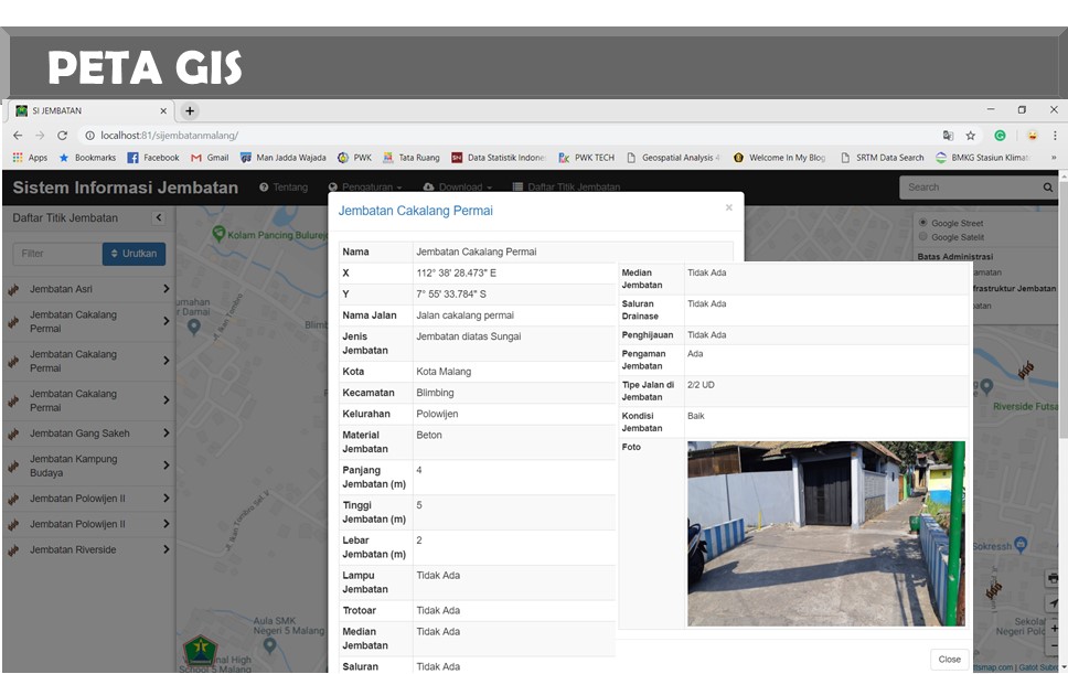
The Gis Map Web Information System. Details
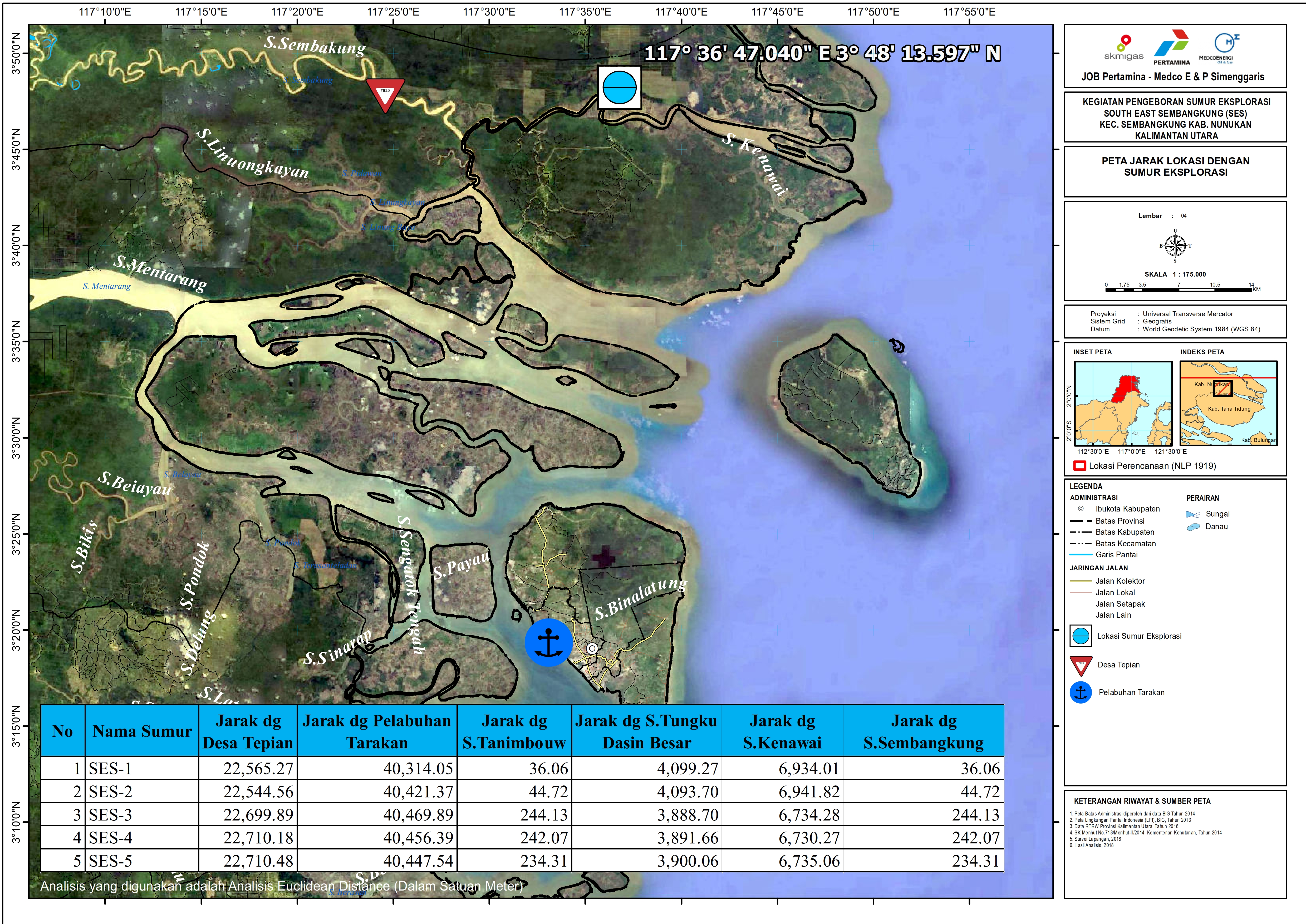
Monitoring using Drones. Details
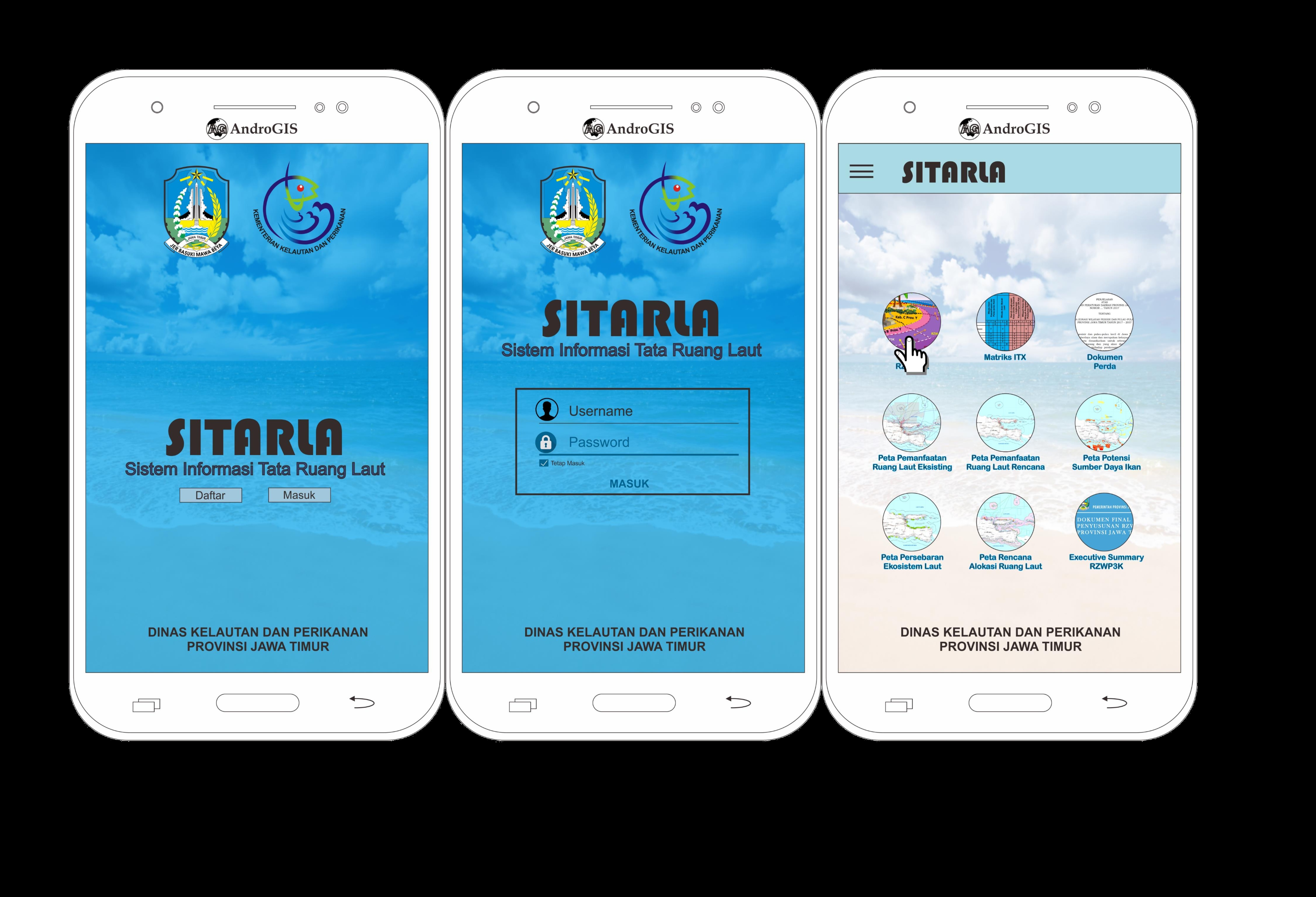
Information system built using leaflets (HTML and javascript). Details
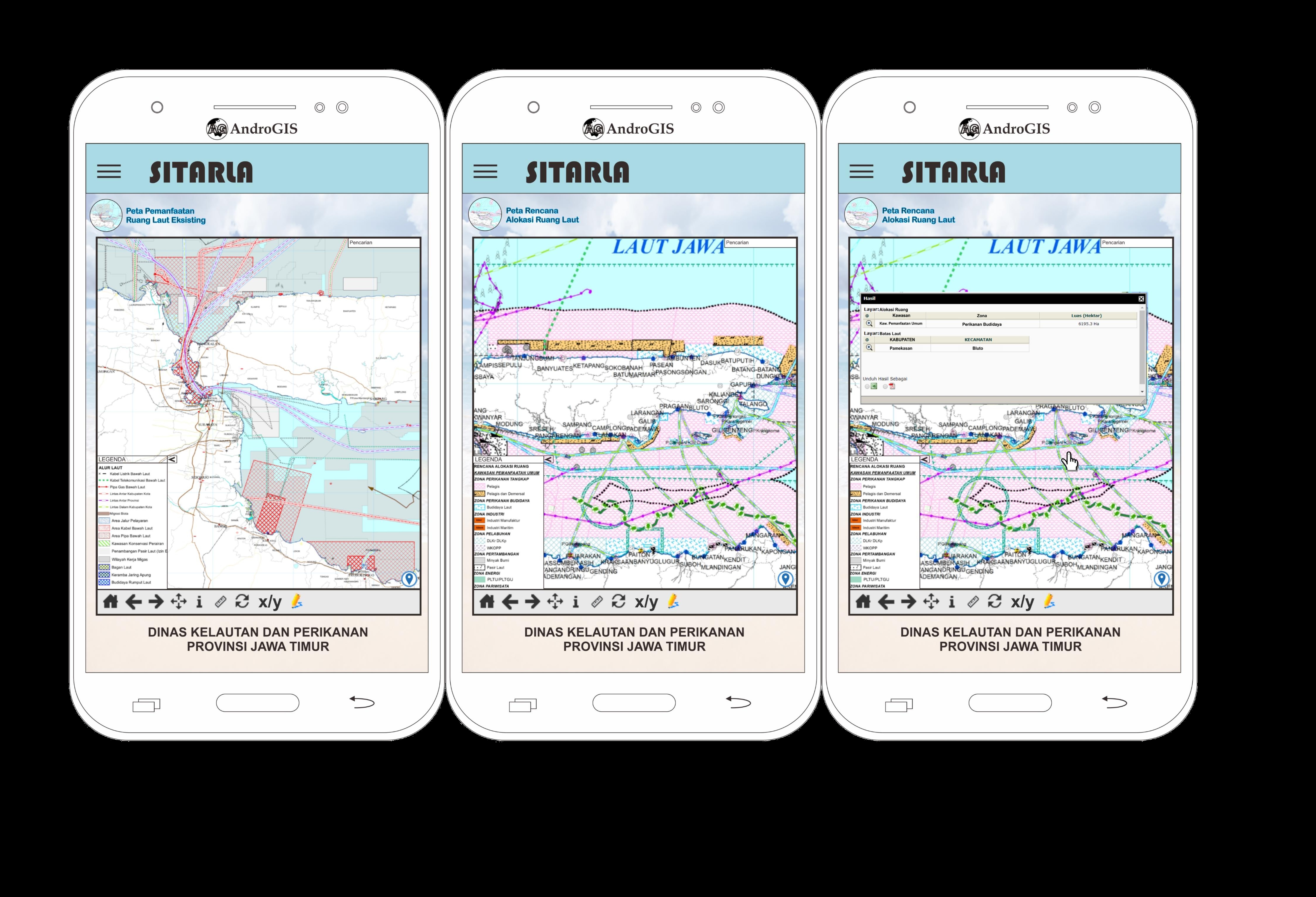


If you are interested and need personnel related to GIS Modeling, Remote Sensing, Drone, WebGis, and Mobile GIS, Please Contact Me.
Jalan Keputih
Sukolilo. SBY
60111 IDN
gatotsubroto@gatsubro.id
info@gatsubro.id
Mobile: (+62) 819 4601 0621